


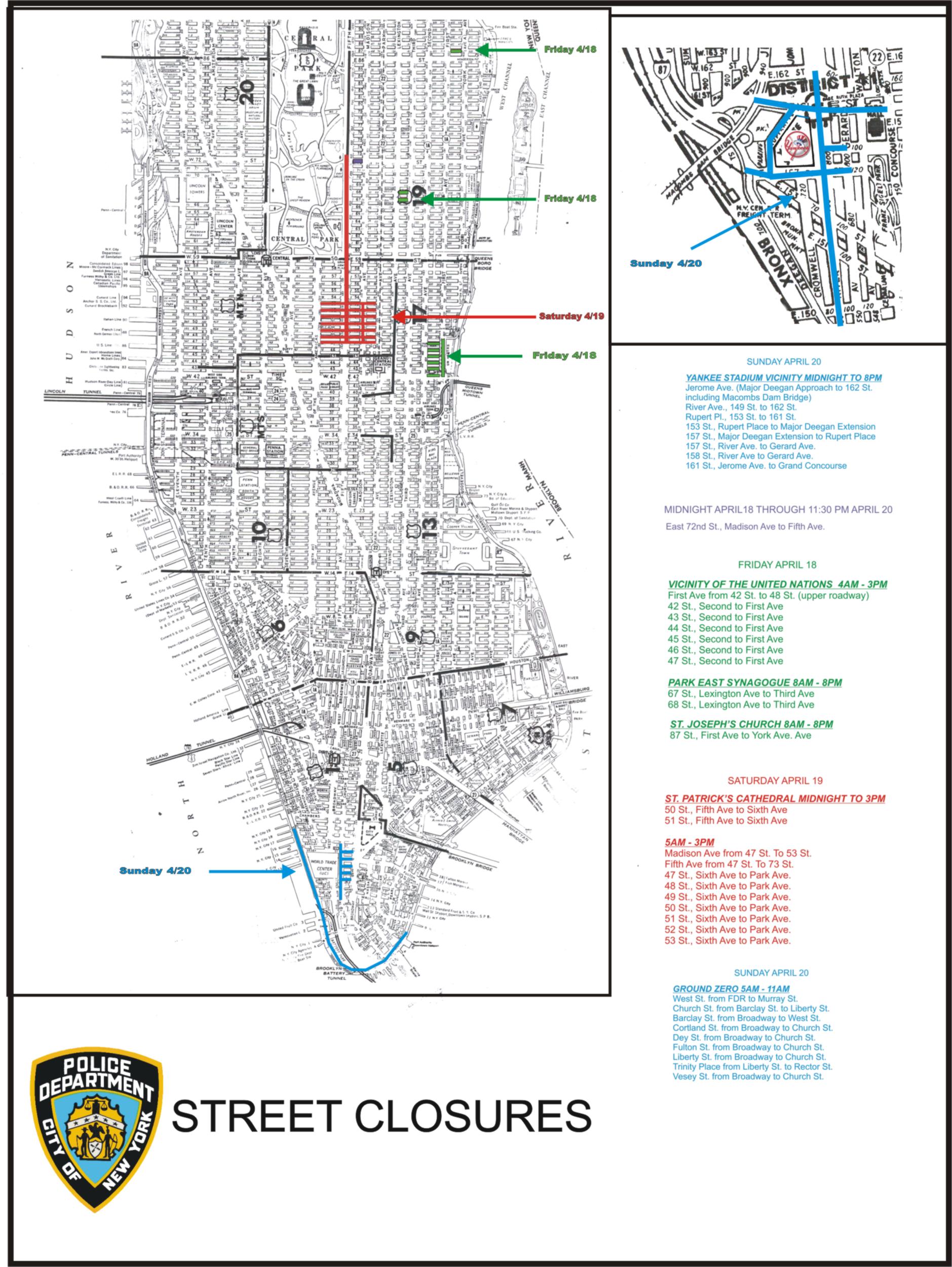
According to a NY Daily News article posted today that the NYPD website upon posting a street closure map this past weekend used a 1960's era map where Roosevelt Island was still listed as Welfare Island.
Maybe the Pope was not a fan of FDR or the City just wanted to look like it did more for those in need?


No comments:
Post a Comment